Putting this list of the best Leavenworth, WA hikes was too easy. After all, this charming Bavarian-themed town is near two national forests, Mt. Baker-Snoqualmie and Okanogan-Wenatchee. However, that means there are so many options to choose from, which can be overwhelming.
You’ll likely find yourself in Leavenworth at some point, so I’m here to help. If you’re not familiar, Leavenworth is conveniently located on Highway 2, one of the only major roads that travels through the mountains to eastern Washington. This makes it an easy pit stop when you need to stretch your legs and check out the many restaurants, wineries, and hikes.
To break down your options, I put together a list of the best hikes in Leavenworth, broken down by difficulty, what passes are required, and what you can expect from each hike. So let’s dive in to find the best hiking spots for taking in the breathtaking beauty of Washington state!
This post has affiliate links, which means I’ll earn a small commission at no cost to you if you click on them and make a purchase. This is a small way I earn money to support this site. If links aren’t showing up for you, turn off your ad blocking software. Thank you for your support!
Leavenworth, WA Hikes
Save this to Pinterest for later because I’ll keep updating this as I discover new Leavenworth Washington hikes! And please remember to follow leave no trace principles and bring plenty of water, sun protection, and snacks!
The Enchantments
website | Stuart Lake Trailhead (get directions) | distance: ~18 mile round trip | elevation gain: ~4,790 feet | difficulty: difficult | NW Forest pass required & wilderness pass for overnight camping
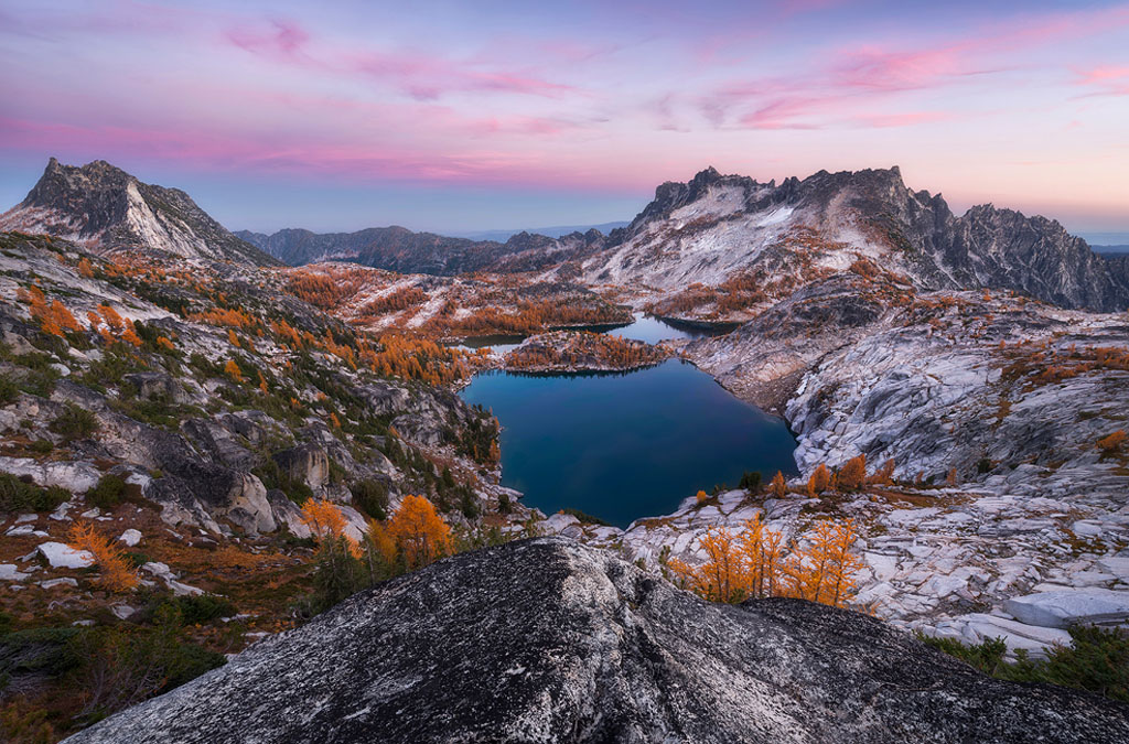
The Enchantments aren’t just one of the best Leavenworth WA hikes…they’re one of the best bucket-list hikes in all of the PNW period. The trail is no small feat, and most who aim to finish do so over several days if they’re able to snag one of the coveted lottery permits. But those who preserve will be met with some of the best views Washington state has to offer.
This is a point-to-point hike, so you’ll want to arrange transportation or pick a spot to turn around. To get here, you’ll park at the Stuart Lake Trailhead. Make sure to use the vault toilets, and bring a trowel if you’re planning on hiking for several days since there are no toilets on the trail.
Regardless of how far you’re hiking, you’ll be rewarded with one of the best views in Washington. Jagged mountain peaks, lakes, and granite cliffs surround you as herds of mountain goats roam by. It’s one of the most popular hikes for fall colors in the PNW because of the golden larches dotting the area. If you’re able to time your trip for then, I highly recommend it!
Colchuck Lake
website | trailhead: Stuart Lake Trailhead (get directions) | distance: ~8.7 mile round trip | elevation gain: ~2,342 feet | difficulty: difficult | NW Forest pass required
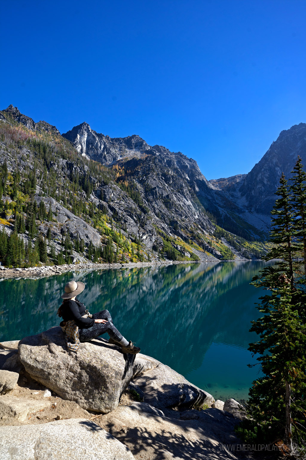
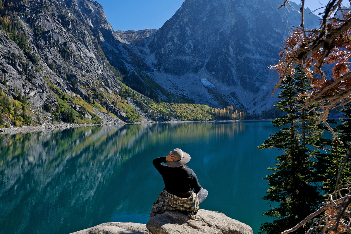
Ask anyone about the best Leavenworth WA hikes, I guarantee Colchuck Lake is at the top of their list. Managed as part of the Okanogan-Wenatchee National Forest, this day hike is one of the two gateways to the Enchantments. To get here, you’ll park at the Stuart Lake Trailhead. Remember to use the vault toilet before you embark on the hike since there are no toilets on the trail.
This out-and-back hike is challenging, with a bunch of false summits and a lot of incline throughout most of the hike. Honestly, I wasn’t sure if I was going to make it at multiple points, and may have cried on the way back down because I was so tired.
However, if you’re in relatively good shape you’ll likely fare better than me. And even though it’s a schlog, the view at the top is totally worth it. The turquoise water reflects the surrounding mountainscape, which is often dotted with larches in fall.
Minotaur Lake
website | Lake Minotaur Trailhead (get directions) | distance: ~3.2 mile round trip | elevation gain: ~1,817 feet | difficulty: moderate | no pass required
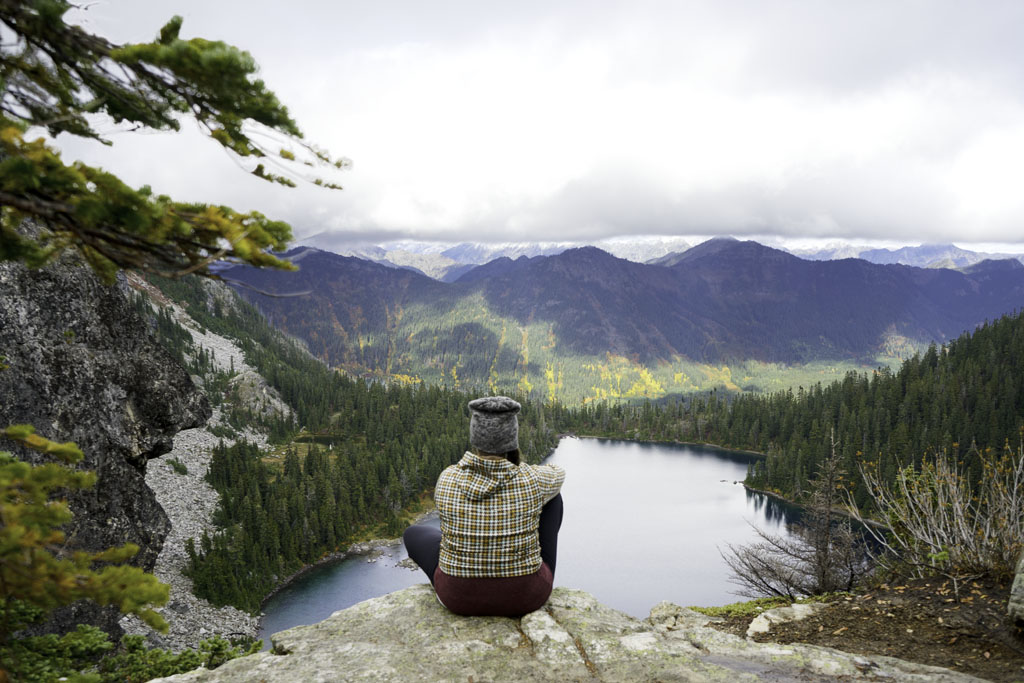
Minotaur Lake is one of the shorter, but still heart-pumping trails on this list of the best Leavenworth WA hikes. The entrance to the trail is east of Stevens Pass, about 39 miles from Leavenworth. It’s a somewhat challenging out-and-back hike that starts off steep but offers picturesque alpine scenery with dense forest, rocky outcrops, and occasional wildlife sightings. It’s also a well-traveled spot for fall foliage hunters and snowshoeing in winter.
The parking lot is small and fills up fast, and there are no toilets at the hike’s entrance, so plan accordingly.
Clara & Marion Lake
website | trailhead: Lake Clara Trailhead (get directions) | distance: ~3 mile round trip | elevation gain: ~944 feet | difficulty: moderate | no pass required
This is the perfect out-and-back hike if you only have a few hours to spare. It’s a 15-mile drive from Leavenworth and starts from the Mission Ridge Ski Area’s parking lot.
The hike can seem difficult since it starts off uphill, followed by switchbacks, but it levels out about a mile from the parking lot and is relatively easy overall. Expect beautiful lakes, mountain vistas, and occasional wildlife sightings. It’s also a great spot for snowshoeing in the winter and larch hunting in the fall.
Lake Wenatchee State Park
website | get directions | distance for north route: ~2.1 mile round trip | elevation gain: ~72 feet | distance for south route: ~1.3 mile round trip | elevation gain: ~59 feet | difficulty: easy | Discover pass required
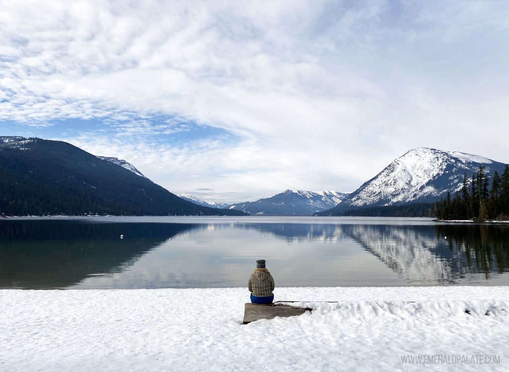
You have two hiking options within Lake Wenatchee State Park. The south trail begins at the boat launch, and the north trail starts after the reservation booth. Both are easy hikes that guide you along the lake and double as beginner-friendly snowshoe and nordic skiing trails in the winter, making it one of my favorite places to visit in Leavenworth during winter.
The north trail is quieter and more serene, while the south trail is more rugged and gives you a higher chance of seeing wildlife, including an occasional bear sighting.
Apple Capital Loop Trail
website | get directions | distance: ~10.1 mile round trip | elevation gain: ~370 feet | difficulty: easy | no pass required
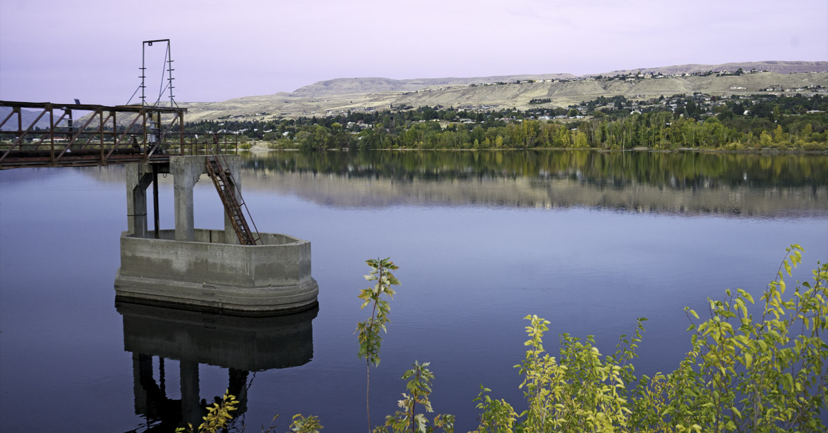
About 30 miles east of Leavenworth is Wenatchee, an underrated town with a lot of fun things to do, including multiple scenic hiking trails.
The Apple Capital Trail is a fully paved loop located in Riverfront Park. It skirts the Columbia River and is a popular spot for dog walkers, bikers, and joggers. The trail has toilets with running water and beach access at multiple points, making it a fuss-free yet rewarding day hike.
Tronsen Ridge
website | get directions | distance: ~11.1 mile round trip | elevation gain: ~2,631 feet | difficulty: moderate | NW Forest pass required
Tronsen Ridge is a moderate out-and-back trail located in the Okanogan-Wenatchee National Forest, 25 miles from Leavenworth. Each season brings something different to look forward to. In the springtime, the wildflowers bloom like crazy. Come fall, you’ll be greeted with larches dawning their finest autumn leaves.
The trail is quite exposed, so bring plenty of sunscreen and water, as the sun can be exhausting in peak season. There are also no toilets, and parking is limited, so arrive early to guarantee a spot.
Carne Mountain
website | trailhead: Phelps Creek Trail (get directions) | distance: ~7.4 mile round trip | elevation gain: ~3,569 feet | difficulty: difficult | no pass required
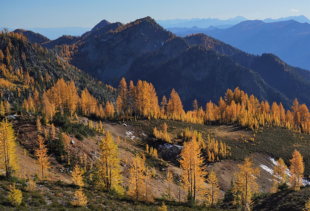
Carne Mountain is a thigh burner if there ever was one. It starts at Phelps Creek Trail before branching off to the narrower Carne Mountain Trail where it gets gradually steeper. The reward starts near the summit, where you’ll get unfettered views of mountain vistas and waterfalls.
There are no bathrooms at the start of the hike, but you’ll pass a few at other trailheads as you drive. The parking lot fills up fast and it’s not unusual to see lines of cars parked on the side of the road.
Icicle Ridge
website | get directions | distance: ~4.8 mile round trip | elevation gain: ~1,758 feet | difficulty: moderate-difficult | no pass required
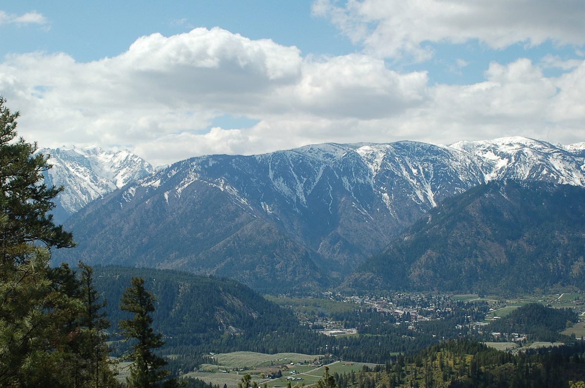
Icicle Ridge is considered one of the best Leavenworth WA hikes thanks to the beautiful scenery it offers from the majority of the trail. It has a relatively gradual, but persistent incline. Luckily there’s a mix of forested and sun-exposed areas, so the chance to rest in the shade is always around the corner.
The trail is well maintained and often free of snow as early as April. In the spring, wildflower blooms take over the meadows, surrounding the ponderosas and reminding you why this is one of the best hiking spots in Leavenworth.
Lake Stuart
website | Stuart Lake Trailhead (get directions) | distance: ~8.9 mile round trip | elevation gain: ~1,840 feet | difficulty: moderate | NW Forest pass required
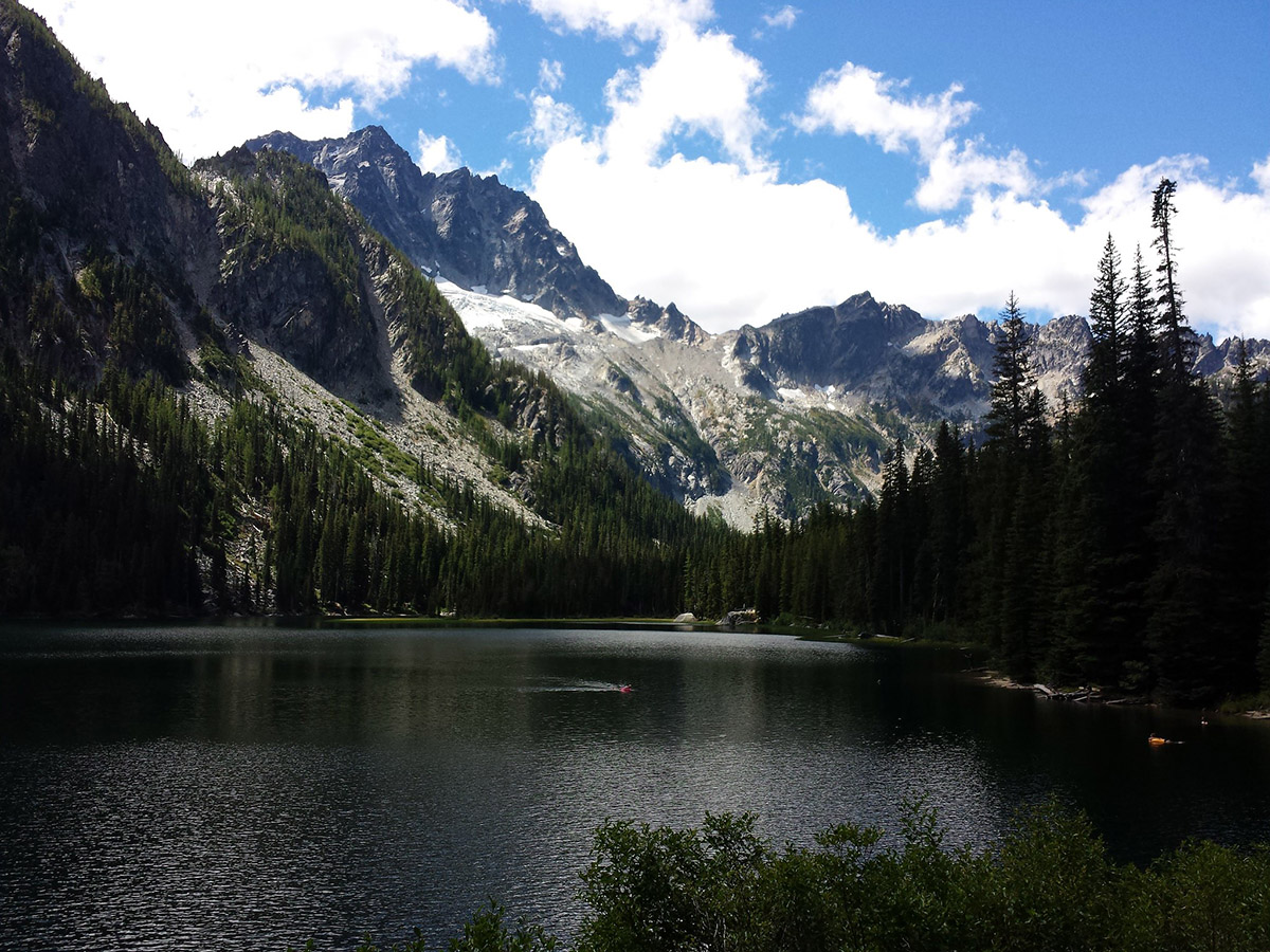
By now you know that Lake Stuart Trailhead is popular because it’s where The Enchantments, Colchuck Lake, and Aasgard Pass depart from. But most people skip Lake Stuart as their final destination. This means that the trail starts off crowded but quickly thins out, leaving you with relative solitude.
The out-and-back trail to the lake can be challenging due to snowy patches, but it’s a well-maintained trail with plenty of payoffs. The imposing view of Mount Stuart reflected off the lake, and subtle sounds of native wildlife add to the “enchanting” vibe.
Eightmile Lake
website | get directions | distance: ~6.7 mile round trip | elevation gain: ~1,410 feet | difficulty: moderate | NW Forest pass required
This is a fairly challenging hike through the Alpine Lakes Wilderness Area. It starts with a log bridge crossing, taking you past burnt ponderosa pines, mountain streams, and wildflower fields along the tree-lined shore.
You’ll pass Little Eightmile Lake about 2.8 miles up, but keep going to your final destination. The real Eightmile Lake is massive, with a rocky, tree-lined shore and jagged cliffsides reflected off the clear waters. There is a toilet at the trailhead but not on the trail.
Dirty Face Peak
website | get directions | distance: ~8.7 mile round trip | elevation gain: ~3,877 feet | difficulty: difficult | NW Forest pass required
The hilariously-named Dirty Face Lookout is one of the first high central Cascade trails to melt, making it accessible early in the year. It breaks up nicely into different sections, starting with lowland forests of ponderosa pines and big leaf maples, followed by a small waterfall fed by the springs that feed Fall Creek. From the falls, you’ll get an unfettered view of Lake Wenatchee.
Expect some switchbacks after the falls, followed by abandoned logging roads. The trail kicks off after the last watering hole (about 2 miles from the trailhead). It’s certainly a thigh burner, but the view of Glacier Peaks and Chiwawa Valley is a suitable reward.
Snow Lakes Trail
website | get directions | distance: ~16 mile round trip | elevation gain: ~4,560 feet | difficulty: difficult | NW Forest pass required
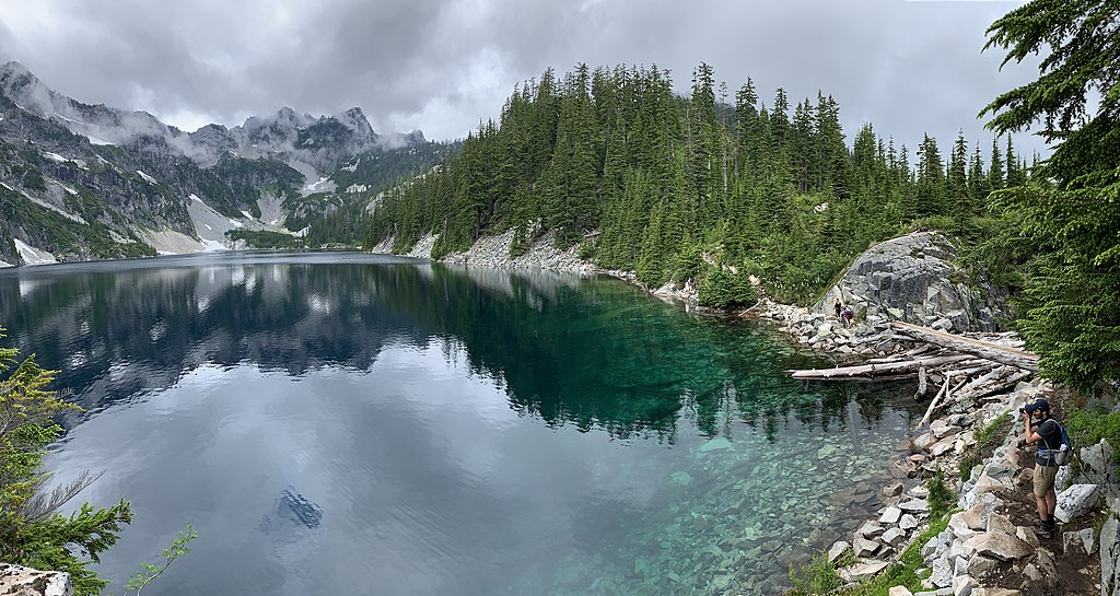
The Snow Lakes Trail is known as the long, gradual way to the Enchantments, but it’s a deceptively grueling destination in its own right. The narrow isthmus between the lake offers a striking view across the water to the daunting heights of McClellan Peak.
The trail starts on Icicle Creek Road and progresses to switchbacks around sooty-scarred trees. As you continue, mountain goats and granite peaks become the norm, and the hike culminates in the expansive Snow Lake, surrounded by stunning vistas.
There are no restrooms on the trail but there are vault toilets at the Snow Lake campground.
Merritt Lake
website | get directions | distance: ~5.3 mile round trip | elevation gain: ~2,000 feet | difficulty: moderate | no pass required
This is one of the under-appreciated hikes in the Stevens Pass area, so you may be lucky enough to experience an uncrowded hike.
The lake is pretty, the mileage is modest, and the switchbacks moderate the elevation gain. Shaded trails mean it’s relatively comfortable in the summer, and the south-facing slope means the snow melts early in the year.
Note, you can continue to Lost Lake from Merritt Lake Trail. However, I only recommend doing this if you’re an experienced hiker because hike reports often claim the extra 1-2 miles is steep and sketchy.
Lake Valhalla Trail
website | trailhead: Smithbrook Trailhead (get directions) | distance: ~6.3 mile round trip | elevation gain: ~1,364 feet | difficulty: moderate | no pass required
Lake Valhalla is tucked under Lichtenberg Mountain on the Pacific Crest Trail north of Stevens Pass. It’s popular in the summer when the wildflowers are blooming and the berries are budding, but in the winter you’ll find equally picturesque snowshoeing trails.
In the summer, there are two ways to reach the lake: the Smithbrook Trail, which is shorter and more kid-friendly, or the Stevens Pass route, which is longer (10 miles) and offers more elevation gain. There are no restrooms at the trailhead, so your best bet is to stop at one of the Stevens Pass lots coming in.
Hidden Lake
website | get directions | distance: ~8.8 mile round trip | elevation gain: ~3,746 feet | difficulty: difficult | no pass required
Few peaks offer such intimate access to the Northern Cascades as Hidden Lake Peak. Starting in the dense forest of the North Cascades National Park, the trail begins with runoff streams and thick brush before opening up below soaring granite cliffs and steep switchbacks.
Eventually, the toughness fades to meadows and wildflowers and panoramic mountain vistas. When you reach Hidden Lake Lookout, you’ll be rewarded with a 360-degree view of iconic North Cascade mountain peaks.
Higher elevation means snowpack stays for longer, so come prepared with spikes and poles. Find a restroom on your drive, as there are none near the trailhead.
Icicle Gorge
website | get directions | distance: ~4.1 mile round trip | elevation gain: ~337 feet | difficulty: easy | NW Forest pass required
About 16 ½ miles west of Leavenworth, this is one of the closest and easiest hikes that offers a big payoff. It’s an easy loop trail that starts from a well-marked parking lot (with a vault toilet), and the steady incline is perfect for newbies and families.
The hike is straightforward, with plenty of signage, winding forest paths, wildflower blooms, and a picture-perfect view of the gorge.
Skyline Lake Trail
website | get directions | distance: ~2.5 mile round trip | elevation gain: ~1,059 feet | difficulty: moderate | no pass required
If you only have time for a short hike but really want it to count, this is one of the best Leavenworth WA hikes. Starting from the large parking area on the north side of Stevens Pass, look west toward a red building and service road to the left. That’s where you’ll start.
A majority of the trail is along the service road before opening up to a nice view of the Stevens Pass Ski Area. If you follow the switchbacks through the huckleberries and pine trees, you’ll reach the lake with a gentle climb before reaching the crystal blue waters.
Sauer’s Mountain
website | get directions | distance: ~5.2 mile round trip | elevation gain: ~1,873 feet | difficulty: easy | no pass required
This trail is technically on private property, though the owner makes it accessible. There are 10 parking spots available, and parking is not permitted beyond the signs. Luckily it’s a relatively underrated hike so your odds of securing a spot are good.
The trail kicks off with totems and carved faces in trees beckoning you to continue. After a few wildflower meadows, you’ll reach a fork in the road. The left fork offers views of the Wenatchee River and Icicle Ridge, while the right fork takes you to a straight path through a shady forest. Take either, as they meet in the middle a mile later, just before the summit.
Blackbird Island Trail
website | get directions | distance: ~1.9 mile round trip | elevation gain: ~52 feet | difficulty: easy | no pass required
If you want one of the best Leavenworth WA hikes right in downtown Leavenworth, Blackbird Island Trail is for you. The tiny walkable island is accessible via a few bridges from Waterfront Park and Enchantment Park. The entire island is under 2 miles, making it an easy leg stretcher in between sampling from Leavenworth’s wineries.
More to do near Leavenworth
After you check off all the best Leavenworth, WA hikes, check out these other things to do in the area.
- Visit the Best Lake Chelan Wineries
- Eat at My Favorite Lake Chelan Restaurants
- Check Out the Quaint Town of Winthrop
- Try All the Best Restaurants in Winthrop
- Visit a Hot Air Balloon Festival in Winthrop
- Follow This North Cascades National Park Itinerary
Overwhelmed by trip planning?
Let me plan you a custom itinerary so all you have to do is show up!

