Finding the best hiking spots in Seattle is both easy and difficult. The easy part is that there are so many to choose from, but it can be difficult to know which ones out of the bunch are worth doing!
The special thing about hiking in Seattle is that you can find easy walks right in the city weaving along stunning water views. Want hiking trails with elevation gain to work a sweat? There are hundreds within about an hour’s drive that have breathtaking waterfalls and mountain scenery.
To help you decide which hiking spots in Seattle are right for you, I’m laying out my favorites and a few suggested by my outdoor blogger friends. I organized them by those right in the city, followed by those a short drive away. You’ll also find information on how long and difficult each hike is, what passes are required, whether you can bring your dog, and more. Happy hiking!
This post has affiliate links, which means I may earn a small commission at no cost to you if you click on them and make a purchase. This is a small way I earn money to support this site. If links aren’t showing up for you, turn off your ad blocking software. Thank you for your support!
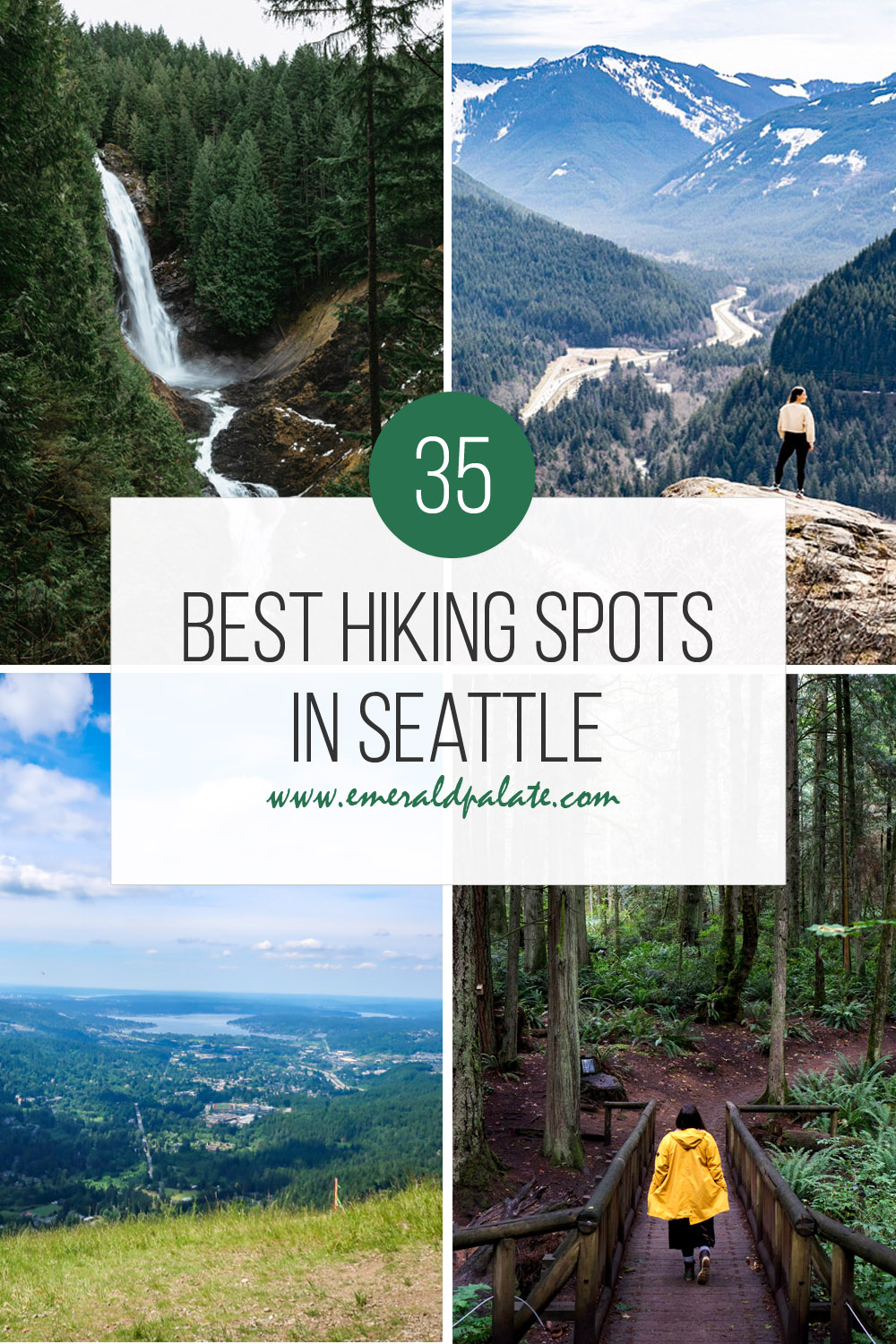
35 Best Hiking Spots in Seattle
Here are hiking trails right in Seattle perfect for an escape from the urban landscape.
Discovery Park Loop Trail
website | Seattle, WA (get directions) | length: 2.8 miles round trip | elevation gain: 140 feet | effort required: easy | no pass required | leashed dogs allowed
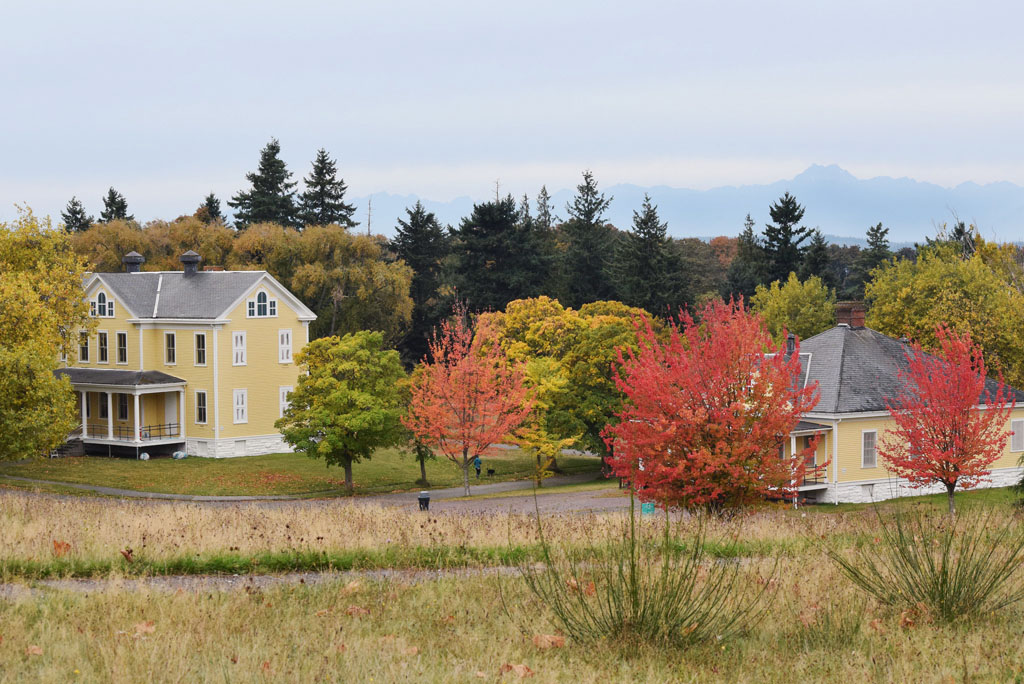
Discovery Park is my favorite hiking area in Seattle. It’s 534 acres and sits on a bluff in the quiet Magnolia neighborhood where few tourists venture. Yet that’s a shame because it’s the largest city park and overlooks the Puget Sound and snow-capped Olympic mountains in the distance.
The Discovery Park Loop Trail weaves around the park. Access the trail from any parking lot and follow it through trees and meadows. When you’re in the meadow you’ll see some ominous homes right in the park. They’re old military base homes, as Discovery Park used to be the former Fort Lawton site.
Where the trees meet the meadow you’ll see a beautiful bluff view of the water. Just be careful not to get too close to the edge, as the sandy sediment isn’t stable.
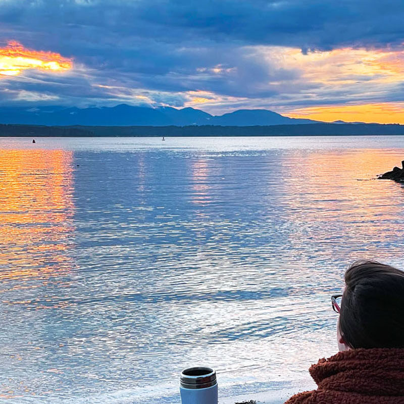
Near this viewpoint is a short shoot off that leads about a half mile to South Beach and West Point Lighthouse. This is a great place to take in the sunset. Keep an eye out for sea glass, especially if you have kids.
Elliott Bay Trail
website | Seattle, WA (get directions) | length: 10 miles round trip | elevation gain: 0 feet | effort: easy to moderate | no pass required | leashed dogs allowed
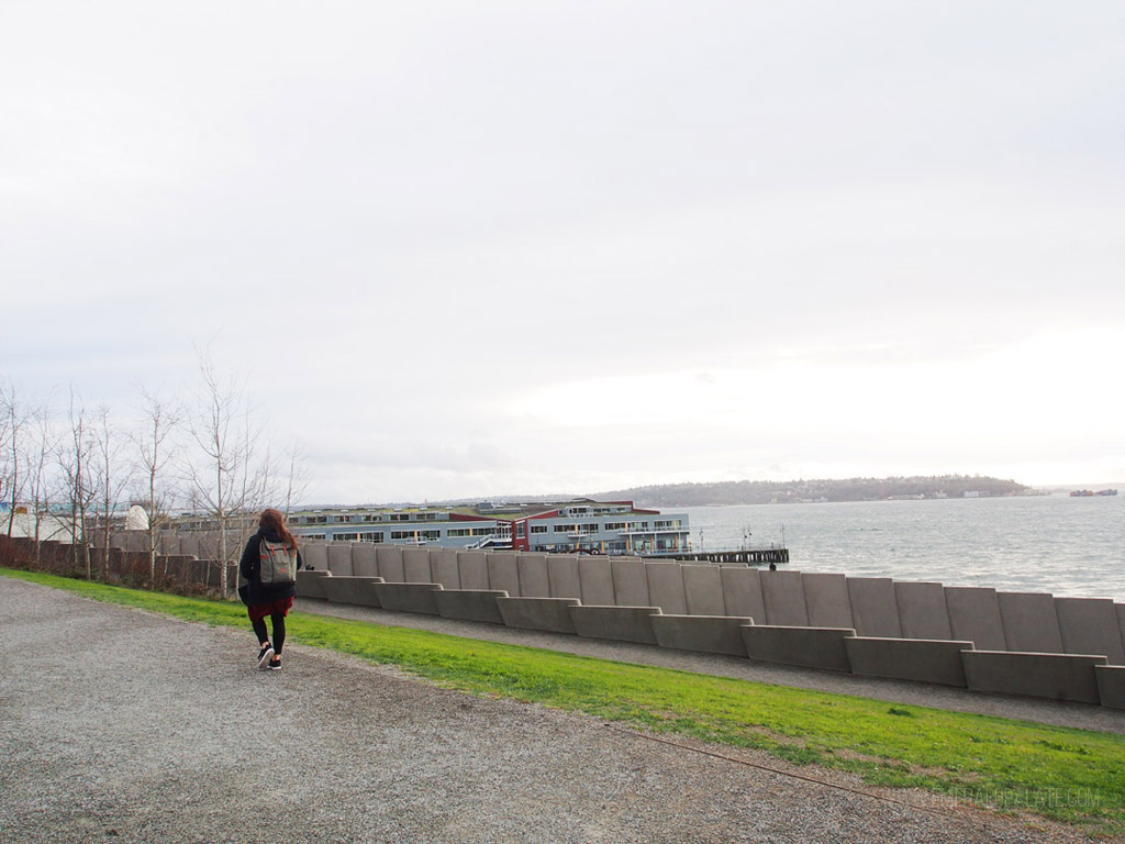
I think this is one of the best hiking spots in Seattle because I used to walk a portion of the trail home when I worked downtown and lived in Magnolia. It starts in downtown Seattle near the Seattle Sculpture Park and follows the coast, meaning a large portion of it has peaceful views.
Starting downtown, you’ll hit Myrtle Edward Park quickly. It’s a little beach where you’ll sometimes see seals. The trail is shared by walkers and bikers, so make sure to follow the signs to stay on the correct side for pedestrians.
As you get further from downtown the scenery will change. You’ll notice it veers left into a train yard. The trail gets a bit narrower and it’ll sorta feel like the zombie apocalypse with machinery, barbed wire, and graffiti.
Don’t let this deter you, because once you get into Magnolia you’ll be near Figurehead Brewing. Stop here for a beer to reward yourself for the walk.
Green Lake Trail
website | Seattle, WA (get directions) | length: 2.8 miles round trip | elevation gain: 0 feet | effort: easy | no pass required | leashed dogs allowed
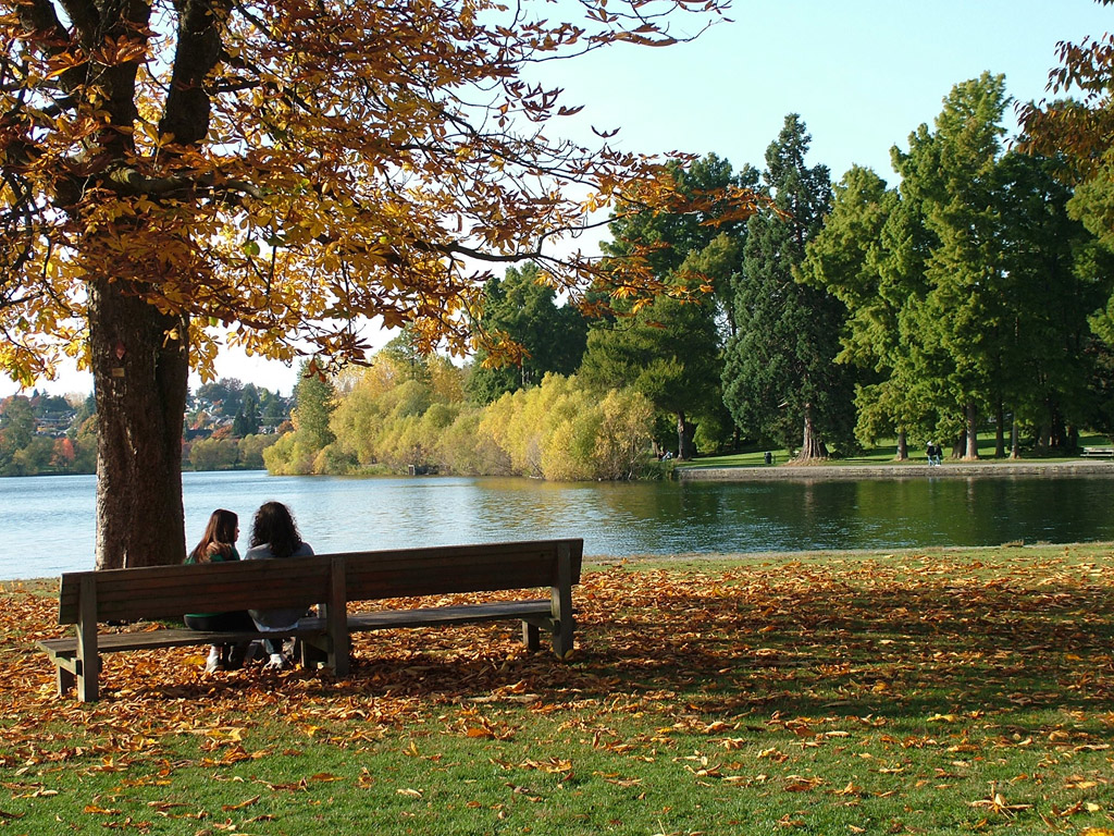
Green Lake is the quintessential place locals go to walk or run. Heck, I go here every weekend in the summer to play softball!
It’s a small lake in the north part of the city that’s great for kayaking, paddle boarding, and swimming in the summer or seeing some of the best fall foliage in Seattle. There’s a paved trail going all the way around it, with grassy knolls perfect for a picnic.
If you want to get a big longer of a walk, take the gravel path closer to the road that runs about 3.2 miles around the lake. It’s a great way to avoid bikes and roller skaters on the shared paved path closer to the water.
You’ll also see stadium steps and a small dock during your walk. It’s a great spot for taking in the views or, if you’re inspired, get some exercise running up and down. This is a move I used to have to do in a bootcamp I did at Green Lake twice a week years ago. Look out for a placard on the wall in front of the stadium referencing famous performers like Led Zeppelin who played at the stadium decades ago!
The boot camp I used to take would also take us across the street near the stadium steps to Woodland Park. I encourage you to check it out as you’ll find some peaceful hiking trails under shaded trees. There’s also a skate and mountain biking park, tennis courts, rose garden, and dog park. You may even here some more exotic animals, as the park grounds are shared with Woodland Park Zoo,
Seward Park Loop Trail
website | Seattle, WA (get directions) | length: 2.4 miles round trip | elevation gain: 0 feet | effort: easy | no pass required | leashed dogs allowed
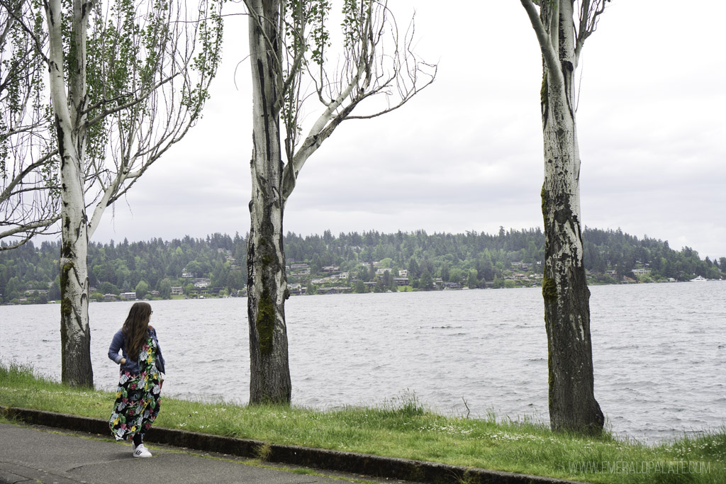
Seward Park is a gem of a park in South Seattle. It has a paved loop path that goes all the way around the park, hugging Lake Washington. That means you’ll get pretty water views, making Seward Park one of the best Seattle viewpoints.
The outer trail is popular, so if you want to escape crowds veer toward the interior of the park at the junction to trail #2 about half a mile in. It’s a shorter route and takes you to a more rugged and wooded trail area accessible by another junction at about 1.75 miles. This is perfect for those who want a bit more of a challenge.
This route will also take you past the old fish hatchery built in 1935. It’s not operational anymore, but you’ll see some remnants and signage with more info about its history.
Washington Park Arboretum
website | Seattle, WA (get directions) | length: 5 miles round trip | elevation gain: 50 feet | effort: easy | no pass required | leashed dogs allowed (except in Japanese Garden)
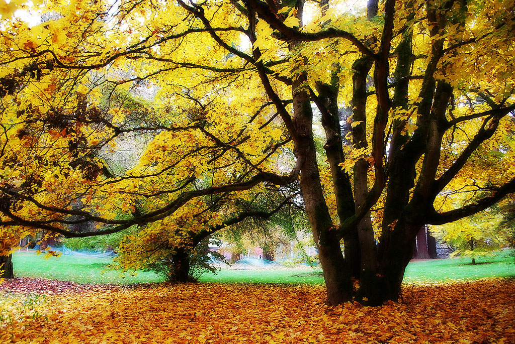
It took me a while to visit the Washington Park Arboretum, but I’m happy I did because it’s one of the best hiking spots in Seattle for people who like gardens. It’s a 230-acre park operated by the University of Washington. It sits on Lake Washington and has a bunch of hiking trails that take you to through different landscapes.
Fo example, in one section you’ll go through the botanical gardens and be surrounded by diverse flowers and plants. In another section there will be looming maple trees, and in yet another a Japanese Garden. You can take a guided walking tour if you want to learn more about the different landscapes.
Lake Union Loop
website | Seattle, WA (get directions) | length: 6 miles round trip | elevation gain: 0 feet | effort: easy | no pass required | leashed dogs allowed
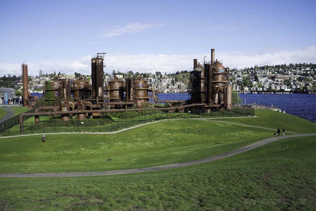
Lake Union is one of my favorite places in Seattle. It’s a great spot for kayaking or canoeing and snooping in all the house boats as you pass. You’ll also find Gas Work Park, one of my favorites in the city with epic views of the downtown buildings and steampunk-esque gas machinery.
Another great way to experience the lake is by walking or running the paved trail that loops all away around it. Start near the MOHAI museum and Lake Union Park near some of the best restaurants in South Lake Union. Halfway around, you can veer off into the funky Fremont neighborhood for some shopping and a self-guided food tour.
As you continue your way around the lake, stop at Westward, one of the best Seattle restaurants with views and some of the best oysters in Seattle.
Carkeek Park
website | Seattle, WA (get directions) | length: 3.5 miles round trip | elevation gain: 800 feet | effort: easy | no pass required | leashed dogs allowed
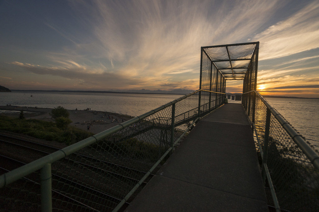
Many locals haven’t even been to Carkeek Park. It’s a heavily-wooded park in north Seattle that pops up sort of out of nowhere off a residential street. It’s quite large, so you drive through it quite a bit before hitting the parking lot.
At the parking lot you’ll see a trail map with a bunch of hiking options. A popular one is Piper’s Creek Trail that takes you through thick forest. It connects with the Wetland Trail that takes you to the beach. Simply cross a bridge that goes over some railroad tracks to access it.
Golden Gardens Trail
website | Seattle, WA (get directions) | length: 2.5 miles round trip | elevation gain: 300 feet | effort: easy | no pass required | leashed dogs allowed
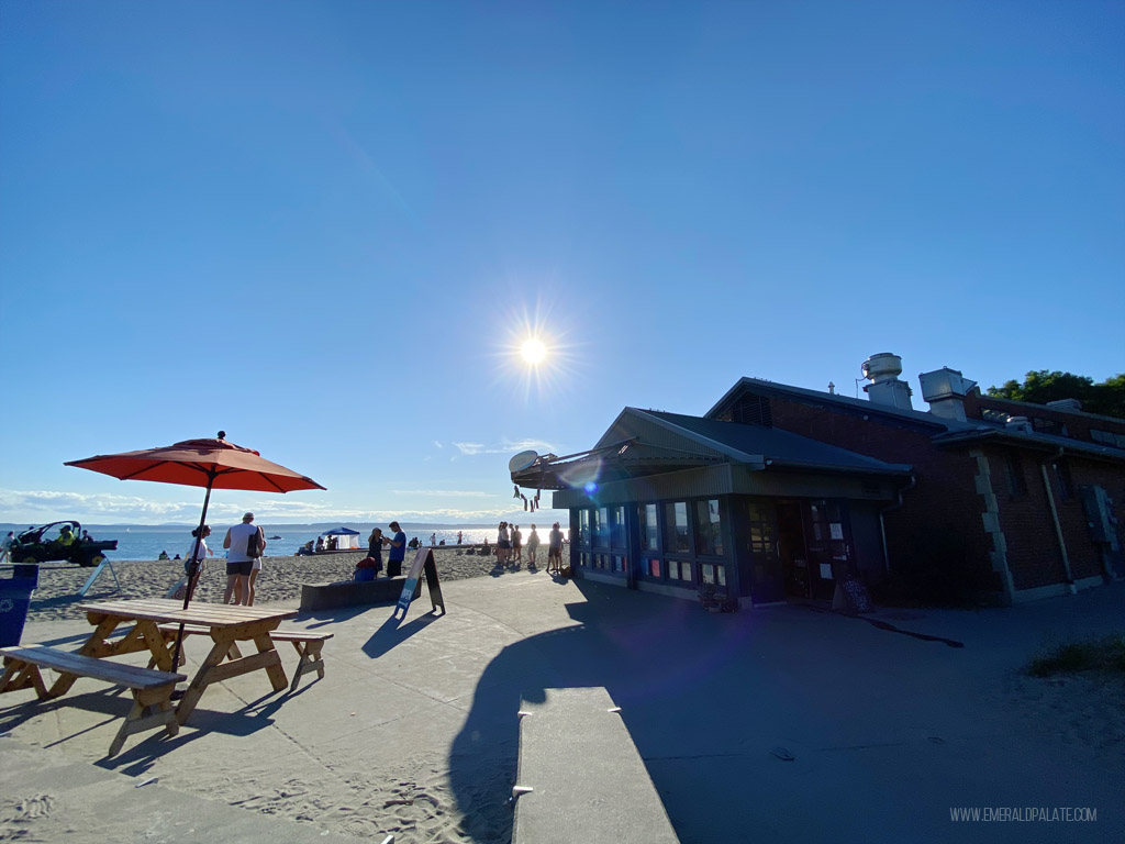
Golden Gardens is one of Seattle’s most popular beaches. It’s super crowded in the summer with people swarming the sand, volleyball courts, and playground. Yet most people don’t realize it’s one of the best hiking spots in Seattle thanks to the trails that take you up the slope behind the beach.
One of my favorite trails starts at the corner of NW 85th Street and 32nd Avenue NW. It begins 300 feet above sea level and then takes you down toward the beach. You’ll meet switchbacks, 80 stairs, and a dog park on your way.
Once you’re at sea level, head under the train track bridge toward the parking lot and beach. Once there, stop at Miri’s for excellent shawarma on the beach, or head to Ballard and take my self-guided Seattle food tour.
Warren G. Magnuson Park
website | Seattle, WA (get directions) | length: 3 miles round trip | elevation gain: 0 feet | effort: easy | no pass required | leashed dogs allowed
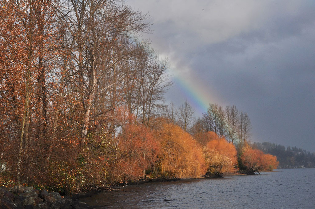
Magnuson Park is a popular spot for Seattle events and holiday markets, but many tourists never visit. It’s a cool area worth exploring, though, as it was once a military base and therefore has a bunch of cool historic buildings.
The park is home to a lot of facilities, such as an indoor sports arena, rock climbing club, gym, and brewery. However, there’s also a network of trails called Frog Pond Trail that offer peaceful walks though a wetland reconstruction project.
The paths will start from the parking lot though overgrown brush before letting out onto Lake Shore Promenade, a paved path along Lake Washington. Along the walkway you’ll see the Fin Project, an installation of old submarine fins, and Kite Hill, a knoll popular for kite flying.
Best Hikes near Seattle
Looking to get out of the city? Here are the best hiking spots in Seattle that you can get to within about an hour and a half. I organized them starting with the hikes closest to the city.
Bridle Trails State Park
website | Kirkland, WA (get directions) | distance from Seattle: ~20 minutes | length: up to 3.5 miles round trip | elevation gain: 450 feet | effort: easy | Discover Pass required | leashed dogs allowed
Bridle Trails is one of the best hiking spots in Seattle for day hiking given its close proximity to Seattle and the Eastside. This 482-acre park is popular for horseback riding and has 28 miles of forested trails.
There are three main loop trails: the 3-mile long Raven Trail, 1.7-mile Trillium Trail, and the 3.5 mile Coyote Trail. All of the loops start from the central junction a short walk from the parking lot.
Whichever trail you choose, expect the soft sound of soil under your feet as you enjoy the shade. You’ll see a ton of birds and can even find Oregon grapes and blackberries on the trail.
Pro tip: Do the trails clockwise so you can better see the signs, as they’re only on one side of the posts.
Richmond Beach Saltwater Park
website | Shoreline, WA (get directions) | distance from Seattle: ~20 minutes | length: 3 miles round trip | elevation gain: 0 feet | effort: easy | no pass required | leashed dogs allowed (there’s an off-leash park too)
I discovered Richmond Beach Park when attending my niece’s graduation ceremony. It’s tucked in a quiet, wealthy neighborhood in Shoreline and offers more than 30 acres of rolling hills, parks, and walking trails.
You can take the trails to the beach for epic sunset views. The vibe is similar to Golden Gardens, but there are way less crowds, making this one of the best hiking spots in Seattle.
St. Edward State Park
website | Kenmore, WA (get directions) | distance from Seattle: ~20 minutes | length: 3 miles round trip | elevation gain: 400 feet | effort required: easy | Discover Pass required | leashed dogs allowed
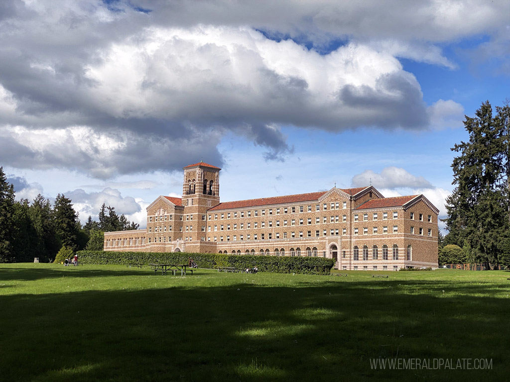
St. Edward Park has been on my list of places to visit because I’ve been dying to stay at the Lodge at St. Edward. The park was purchased by the Seattle Catholic Archdiocese, who built a seminary in the 1930s. The hotel is built inside that historic seminary and has really dreamy ambiance.
You’ll find a bunch of amenities in the 316-acre park, including sports fields, mountain biking trails, playgrounds, and picnic areas. There are also a ton of trails to choose from, the most interesting of which leads to the rugged, undeveloped shore of Lake Washington.
If you want a bit more of a thigh burner, take the 0.4-mile Grotto Trail down to the water. Others, like me, who prefer a bit more gradual of a trail should take the 0.62-mile Seminary Trail. It’s behind The Lodge, so you can visit the historic stone grotto that used to be an altar before heading to the wooded trail.
Coal Creek Trail
website | Newcastle, WA (get directions) | distance from Seattle: ~20 minutes | length: 6 miles round trip | elevation gain: 550 feet | effort: easy | no pass required | leashed dogs allowed
Coal Creek Trail is one of the best hiking spots in Seattle for exploring Cougar Mountain just a short drive from the city. It’s an easy hike in a historic area that was once busy with railroad and coal mining activity up until the mid-1900s. You’ll see interpretive signs and an airshaft coal mine that extends more than 500 feet below sea level.
There are multiple parking lots, so this hike is great if you want to take shorter walks. Just make sure you don’t miss the pretty North Fork Falls!
Saltwater State Park
website | Des Moines, WA (get directions) | distance from Seattle: ~25 minutes | length: 2 miles round trip | elevation gain: 0 feet | effort: easy | Discover Pass required | leashed dogs allowed
Saltwater State Park sits on the coast between Seattle and Tacoma, making it a great urban getaway if you’re short on time. You can go just for the pretty beach views, or stay to take one of the meandering trails through the forest.
The trails connect the various parking lots, so park wherever is convenient. Make sure to leave time for exploring the tide pools, especially if you have kids in tow.
Snoqualmie Falls
website | Snoqualmie, WA (get directions) | distance from Seattle: ~30 minutes | length: 1.4 miles round trip | elevation gain: 250 feet | effort: easy | no pass required, but main parking lot has a fee | leashed dogs allowed
Snoqualmie Falls is one of the quintessential best hiking spots in Seattle. Its claim to fame is being featured in the cult classic show Twin Peaks, drawing more than 1.5 million visitors per year. Before that it was always a sacred place, though. The Snoqualmie Tribe considers it the origin of humanity because of its magnificence.
The area is managed by Puget Sound Energy because the impressive 268 foot falls generate a lot of electricity for the area. The trail is only 0.7 miles down to the base of the falls, but you can see the water almost immediately from the parking lot. You’ll find interpretive signs along the way to keep both adults and kids alike entertained.
Pro tip: The upper and lower parking lot provide free parking. You’ll also find clean toilets there.
Rattlesnake Ledge
website | North Bend, WA (get directions) | distance from Seattle: ~30 minutes | length: 4 miles round trip | elevation gain: 1,160 feet | effort: moderate | no pass required | leashed dogs allowed
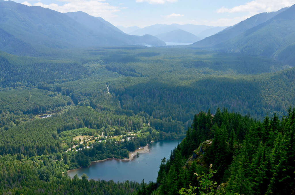
Rattlesnake Ledge is a popular hike for locals and visitors alike, making it one of the best hiking spots in Seattle. Though the hike is rated as moderate, it is frequented by people of all hiking levels. While the parking lot is large, it can get crowded as it is for hikers as well as people accessing the nearby lake.
The out-and-back Rattlesnake Ledge trail is accessible all year long. Spring and fall offer comfortable hiking temperatures. While summer has the best chance of sunshine and warm weather, it’s the most popular time of year so the trail can get extra crowded. Come early or mid-week to have the best chance of avoiding big crowds.
While beautiful, the trail zig zags through a thick forest, so you won’t get views until the top. Your efforts will be rewarded with sweeping views over Rattlesnake Lake and the forested valley below. It’s this epic viewpoint that makes it one of the best hikes in Washington state. Be sure to pack water and snacks to enjoy before your hike down.
If you’ve worked up a sweat, you might want to take a post-hike dip in Rattlesnake Lake, which is located near the trailhead.
Contributed by Katie Zweber from Go Wander Wild
Poo Poo Point Chirico Trail
website | Issaquah, WA (get directions) | distance from Seattle: ~30 minutes | length: 3.8 miles roundtrip | elevation gain: 1,760 feet | effort: moderate | no pass required | leashed dogs allowed
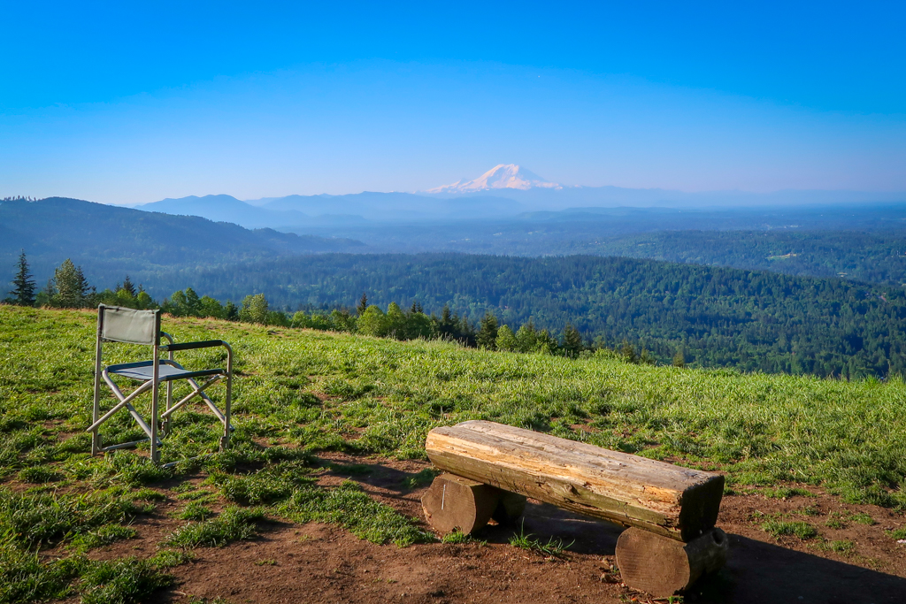
Poo Poo Point Chirico Trail is a short out-and-back hike close to Seattle in the Issaquah Alps. You’ll find vault toilets, so use the restroom ahead if that’s not your thing.
The trail leads to Poo Poo Point, a knob on the side of Tiger Mountain that features incredible panoramic views of Puget Sound. The hike also includes a spectacular vista of Mt. Rainier along the way.
On sunny days, hikers may get a chance to see paragliders soaring through the air at Poo Poo Point. Paragliders frequently use the location as a jumping off point before eventually landing in a field near the Chirico Trailhead. Be sure to use caution when crossing the field to ensure you aren’t in someone’s landing path!
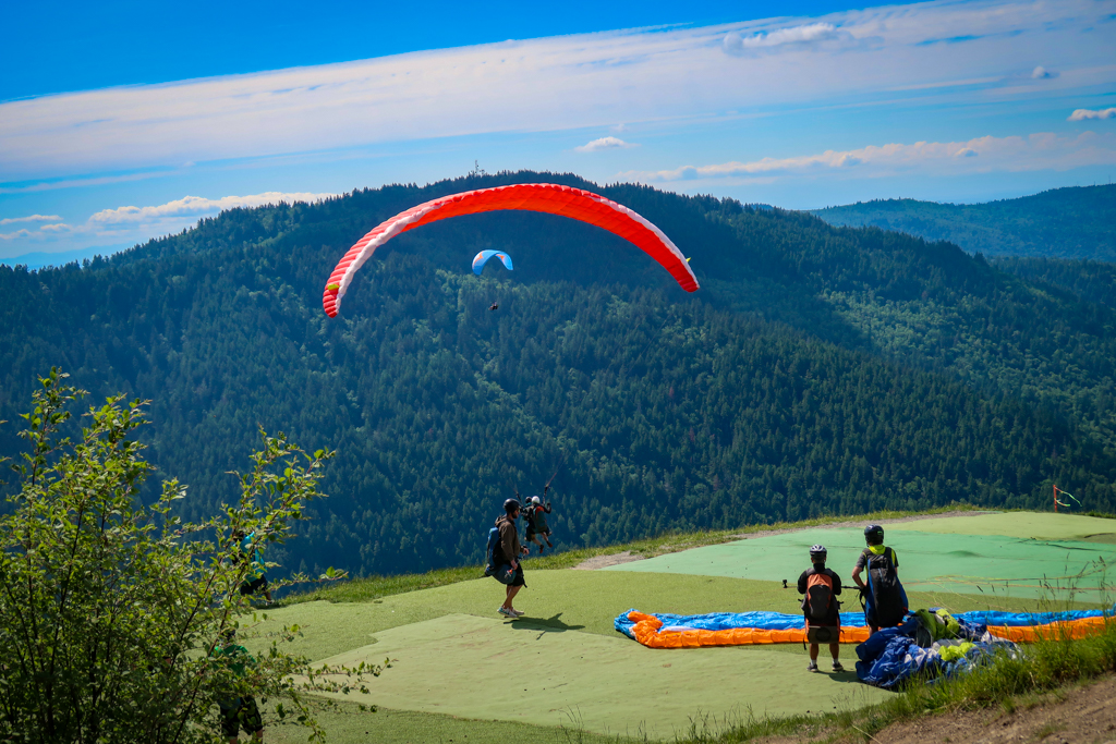
Chirico Trail’s short distance from Seattle and incredible payoff make it one of Seattle’s best hikes. While the trailhead does boast a fairly large parking area, it often fills early. Consider visiting on the weekday or arriving early to secure a spot.
Before heading to the trailhead, be warned that the trail is a challenging one for many hikers due to the steep incline and lots of steps.
If this isn’t your speed – you’re in luck. There is another option. The Poo Poo Point High School Trail also leads to Poo Poo Point and is a great alternative.
If you’re not sure which Poo Poo Point Trail is right for you, be aware that the Chirico Trail is shorter (and steeper) but has a larger parking lot and attracts bigger crowds. The High School Trail is longer and less challenging, but the parking lot is smaller. While it doesn’t include a vista of Mt. Rainier along the way, the High School Trail does offer easy access to other trails on Tiger Mountain.
Contributed by Katy Shaw of A Rambling Unicorn
Mount Si
website | North Bend, WA (get directions) | distance from Seattle: ~40 minutes | length: 8 miles round trip | elevation gain: 3,150 feet | effort: moderate | Discover Pass required | leashed dogs allowed
Ask anyone where the best hiking spots in Seattle are, and Mt. Si is bound to be on their shortlist. This is a wildly popular hike given its proximity to Seattle, so expect an overrun parking lot if you don’t get there very early. However the effort is worth it because you’ll be rewarded with incredible views of Mount Rainier and the surrounding area at the top.
You’ll start climbing almost immediately at the start of the trailhead, but the ascent is gentle with switchbacks. It flattens a bit after the first 1.5 miles when you get to Snag Flat, an area of old-growth trees that survived both fire and logging.
Many people rush through this, but give your thighs a break and appreciate the huge trees. There’s actually a tribute to pioneering state legislator, Frances North, for her work protecting the area from over logging.
Pro tip: If you’re not ready for an 8 mile hike, do the 3.7 mile Little Si trail nearby.
Dirty Harry’s Balcony
website | North Bend, WA (get directions) | distance from Seattle: ~40 minutes | length: 4.4 miles round trip | elevation gain: 1,600 feet | effort: moderate | Discover Pass required | leashed dogs allowed
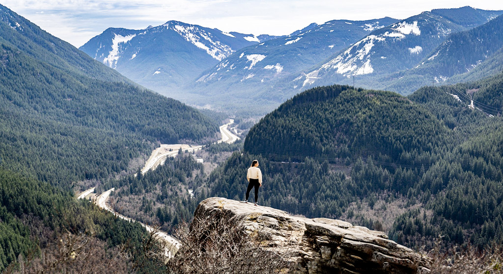
Dirty Harry’s Balcony is an incredible trail through a lush fairytale forest to a rocky cliffside overlook of the Snoqualmie River Valley below. This out-and-back hike is awesome, not only due to its stunning mountain views, but also for the excellent rock-climbing opportunities on the enormous boulders and rock faces surrounding the trail. And better yet, you can enjoy this trail year round.
While it often gets a bit of snow and ice from November through February, it usually doesn’t receive the heavy snowfall seen throughout the rest of the Snoqualmie Pass. So if you’re visiting during that time frame, just be sure to bring along some micro spikes!
Because of its accessibility and proximity to Seattle, this hike is quite popular, so it’s best to show up early during summer weekends to snag a parking spot. From there, it’s a 2-mile uphill climb through second-growth forest to several natural overlooks of the surrounding mountains, including McClellan Butte, Mount Kent, and Mount Washington.
While most hikers decide to rest and eat lunch at the eponymous overlook, Dirty Harry’s Balcony (named after a logger from the 1940s), the best view is actually from a viewpoint earlier on in the trail. This overlook is called Winter Block and, unlike Dirty Harry’s Balcony, provides completely unobstructed panoramic views of the surrounding mountains.
Contributed by Jessica Schmit of Uprooted Traveler
Mailbox Peak
website | North Bend, WA (get directions) | distance from Seattle: ~45 minutes | length: 9.4 miles round trip | elevation gain: 4,000 feet | effort: difficult | Discover Pass required | leashed dogs allowed
This hike is not for the faint of heart, as it’s a thigh burner pretty much the whole way up. Can you believe it used to be more difficult before the Washington Trail Association (WTA) made a safer, slightly less steep trail? I haven’t done the new one yet, but I remember hiking the original trail in my early 20s and wondering if I made a mistake.
The work will be worth the payoff though. At the peak you’ll be on a ridge line with uninterrupted panoramas of Mt. Rainier and Middle Fork Valley. You’ll also see the famous mailbox decorated with graffiti. People have also reported finding other items like toys and a fire hydrant at the summit, so keep your eyes peeled for interesting treasures turned art.
Twin Falls
website | North Bend, WA (get directions) | distance from Seattle: ~45 minutes | length: 2.6 miles round trip | elevation gain: 500 feet | effort required: moderate | Discover Pass required | leashed dogs allowed
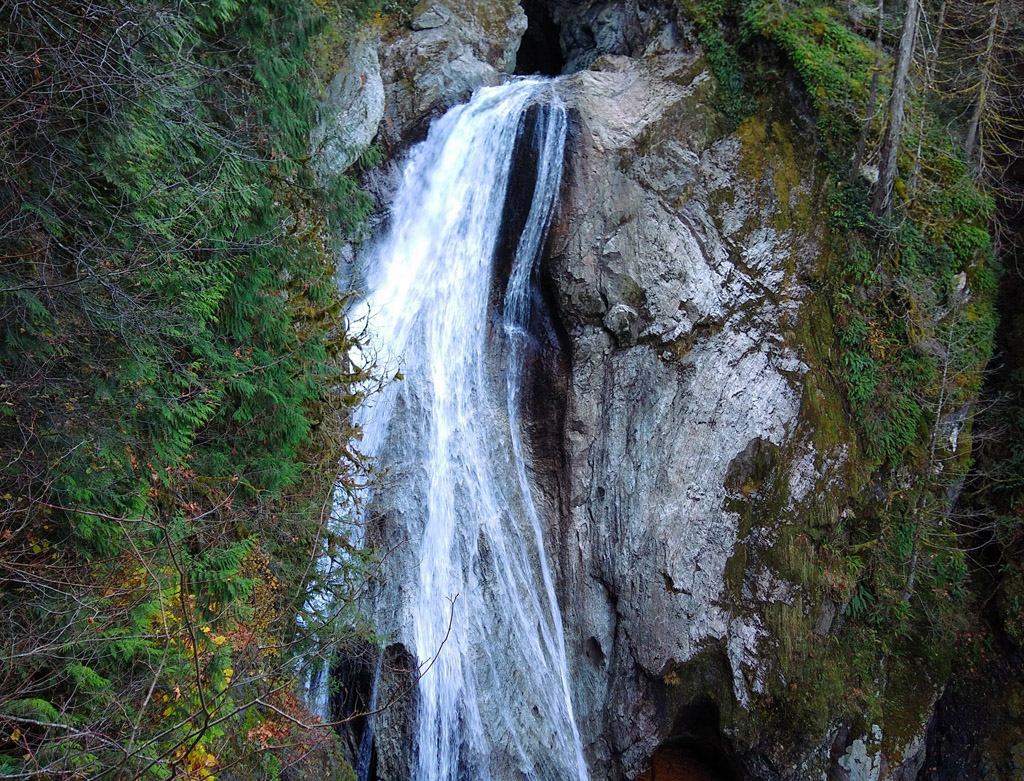
The Twin Falls hike is a gorgeous out-and-back temperate rainforest hike through a fern and moss-filled forest. Since it’s under an hour from Seattle, this hike makes the perfect weekend morning or after work hike.
Twin Falls is very popular with families, as kids love climbing over the massive logs. You’ll weave along the edge of a rushing river lined with old-growth trees to get to the main attraction of this hike: a stunning waterfall.
But you’ll have to work a bit to get there. About halfway to the falls, a lovely wooden bench with a view of the waterfall helps with motivation to keep going, especially for kids or adults who are not frequent hikers. The trail can be very muddy at times, so make sure to wear waterproof footwear with good traction.
Twin Falls is an excellent year round hike and during the winter it’s not very crowded. It gets extremely crowded in summer, though, so try an evening hike to beat the crowds and easily find a parking spot.
Pro tips: On your way back to Seattle, stop at Volition Brewing for some tasty beer or the North Bend Bakery for an amazing post-hike cookie. You can also check out the Twede’s Cafe of Twin Peaks fame or the locally beloved Dairy Freeze.
If you’re looking for some caffeine before the hike, Pioneer Coffee is a great choice. North Bend Bar and Grill has delicious classic bar food, as does Snoqualmie Falls Brewery.
Contributed by Jennie Flaming of Ordinary Adventures
Wallace Falls
website | Gold Bar, WA (get directions) | distance from Seattle: ~1 hour | length: 3.7 miles to Lower Falls, 5.6 miles to Upper | elevation gain: 1,300 feet | effort: moderate to difficult | Discover Pass required | leashed dogs allowed
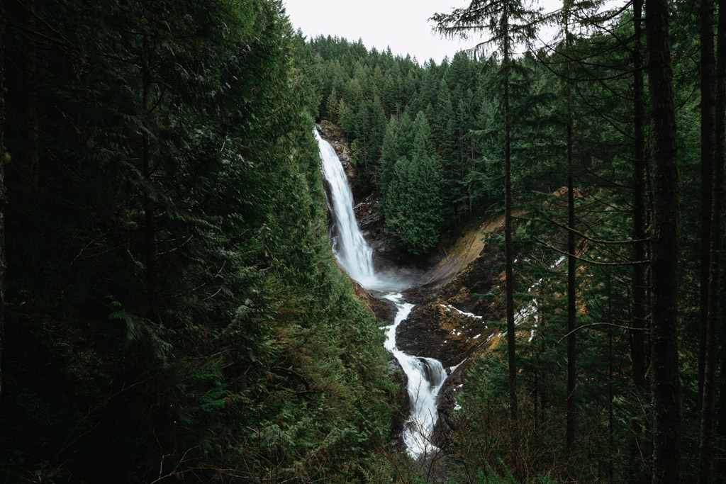
Wallace Falls Trail is one of the best hiking spots in Seattle because of the proximity to the city and variety of trail features it has: waterfalls, river, rainforest, bridges, and more. It’s located in Wallace Falls State Park about 50 miles away from Seattle.
The hike is best known for views of Wallace Falls. The waterfall drops 256 feet and is quite a magnificent thing to witness from the viewing area. Most people stop and turn around at the lower viewpoint. However, you can extend your hike and continue on to other viewpoints if you are looking for more of a challenging hike.
It’s best to do this hike on a weekday if possible, as the weekend crowds can get quite large. There is a large parking lot available, and a Washington State Discover Pass is required. You can bring one from home or purchase one at a kiosk on site.
Pets are allowed on the trail, but it’s strictly enforced that they stay on a leash the entire time. Don’t forget to bring plenty of water on this trail. You’ll climb 1,300 feet in a relatively short amount of time, which means water breaks will be often and necessary!
Finally, don’t forget to bring your camera! Whether on a phone or DSLR, this is a great time to try out the long exposure feature on your camera’s settings to make the waterfall blur to look like silk.
Contributed by Emily Mandagie of The Mandagies
Franklin Falls
website | North Bend, WA (get directions) | distance from Seattle: ~1 hour | length: 2 miles round trip | elevation gain: 364 feet | effort: easy | Northwest Pass required | leashed dogs allowed
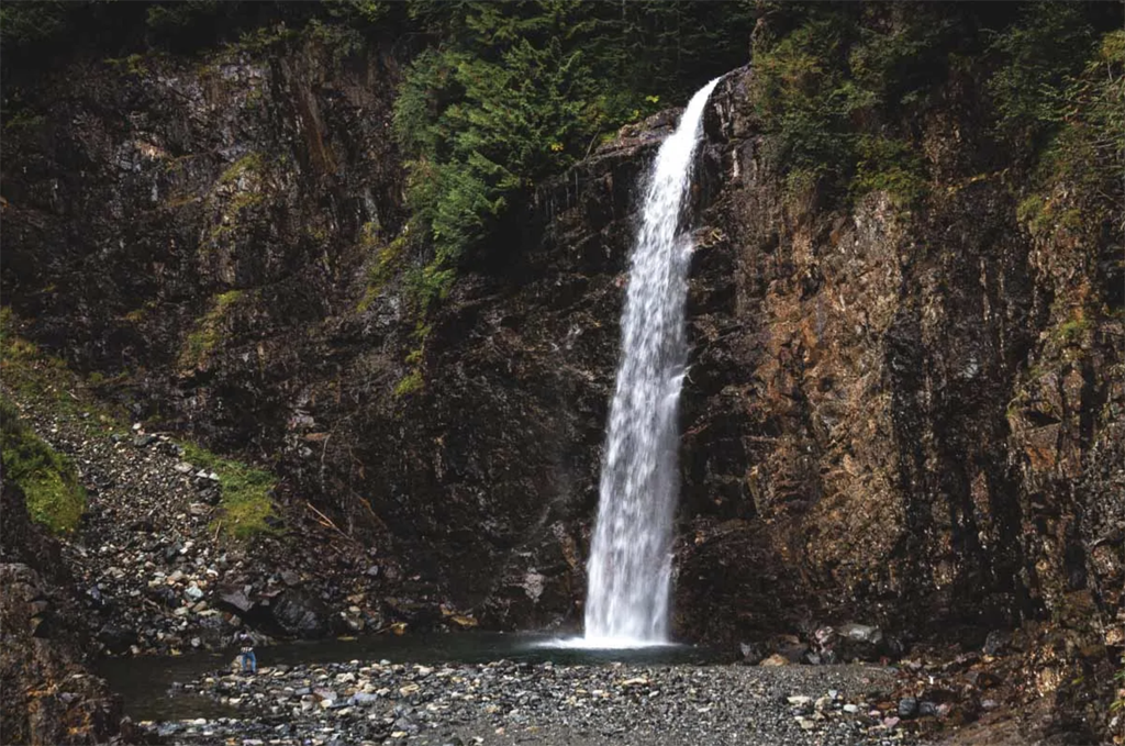
Hiking the Franklin Falls Trail is the perfect getaway for Seattleites to chase waterfalls without having to go too far. It’s just an hour out of the city and pretty much anyone can tackle it.
Franklin Falls plunges a steep 70-feet off a cliff into a small pool below. The waterfall is fullest in spring, but you should see water year round. If you come during the warmer months, feel free to take a dip in the pool below.
If you visit after the snowmelt, you’ll only have to hike the easy 2 miles round trip. However if you go in winter, you’ll have to park further and hike around 6-7 miles round trip.
Be sure to display your Northwest Pass in the parking lot, NOT your Discover Pass. Your pups are welcome to join if they are leashed, and the hike is easy enough for kids too.
The only area that gets a bit hairy is right at the end when you get to the waterfall. You have to do a bit of rock scrambling to get to the base of the falls, and sometimes, due to the waterfall mist, the rocks are extra slippery. So take care and wear good shoes.
Pro tip: Twin Falls and Snoqualmie Falls are within the area, so you can knock out all three falls for one of the best scenic day trips from Seattle.
Contributed by Nina Ragusa of Washington is for Adventure
Cherry Creek Falls
website | Duvall, WA (get directions) | distance from Seattle: ~1 hour | length: 5 miles roundtrip | elevation gain: 450 feet | effort: easy | no pass required | leashed dogs allowed
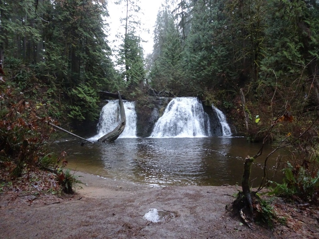
While these falls are only 25 feet high, Cherry Creek Falls has a lot going for it. It’s suitable for all ages and close enough to Seattle for a day hike. Plus, you can do it year round regardless of the weather.
You can approach the falls either by doing a loop or going out-and-back. Expect to see some old, rusted cars along the way before you get to the falls.
If there’s been rainfall recently, there is one creek crossing right before the falls that can be tricky so waterproof shoes are a must! Poles or even a handy stick can help keep your balance. In summer, the pool beneath the waterfall can be good for a refreshing dip, but a rainy day offers more solitude and gushing falls!
As this is on private land, there are no fees or passes required to park. However, parking can get crowded, especially on nice summer weekends. Cars parked illegally will be ticketed or towed, so pay close attention to signs and driveways.
Pro tip: After the hike, Valley House Brewery (21+) is just five minutes away from the trailhead with tasty food and beer to wind down…or dry off!
Contributed by Gabby Fraley of Wet Boots Dry Hops
Grand Forest
website | Bainbridge Island, WA (get directions) | distance from Seattle: ~1 hour | length: 7 miles round trip | elevation gain: 0 feet | effort: easy | no pass required | leashed dogs allowed
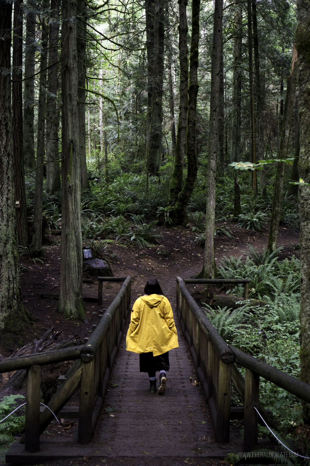
Grand Forest is a beautiful, tree-filled area in the north part of Bainbridge Island. It has a trail network that spans three sections: Grand Forest East, West, and North.
My favorite section is the West because it’s less crowded than the East and has an nice variety of trails that take you through dense forest and ponds. There’s also a cute bridge that makes for pretty photo opportunities.
Pro tip: Grand Forest West is a must do when spending one day on Bainbridge Island. However, take a photo of the map at the parking lot because the trails have a lot of misleading turns.
Snow Lake
website | North Bend, WA (get directions) | driving time from Seattle: ~1 hour | length: 7.2 miles round trip | elevation gain: 1,800 feet | effort: easy to moderate | Northwest Pass required | leashed dogs allowed
Snow Lake is the most visited alpine lake in the Alpines Lake Wilderness in the Okanagan-Wenatchee area of central Washington. That’s because despite it’s length, it’s not a very difficult hike.
The trail departs from the Alpental Ski Area parking lot and begins with a climb up log steps. There’s a gentle ascent into the forest from there before heading into a clearing that looks far more remote than the parking lot you just left.
Views are pretty almost immediately, but they keep getting better and better as you approach the lake. Once there you’ll see the slopes reflecting in the water, making for pretty photo opportunities and a great place for lunch.
Pro tip: Because of the short, but steep ascent to this trail, this hike is prone to avalanches and can be dangerous in winter.
Billy Frank Jr. Nisqually National Wildlife Refuge
website | Olympia, WA (get directions) | distance from Seattle: ~1 hour | length: 10 miles round trip | elevation gain: 10 feet | effort: easy | $3 parking pass required (have cash) | leashed dogs allowed
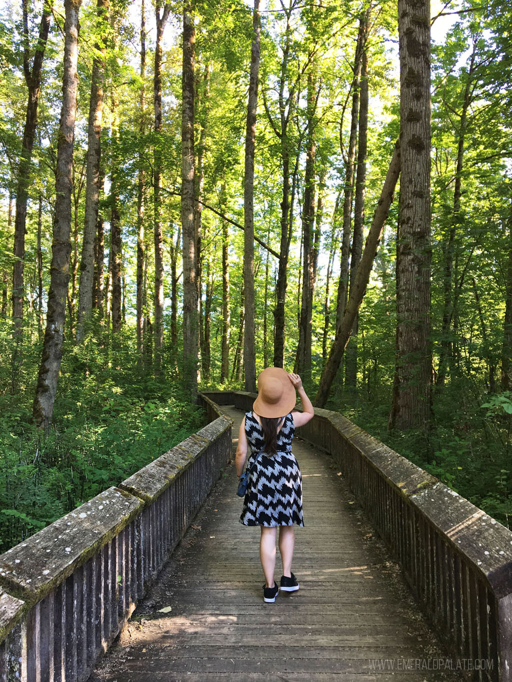
The Billy Frank Jr. Refuge is one of the best things to do in Olympia, our state capital. It’s a large nature reserve with a ton of flat walking trails perfect for birdwatching and animal sightings (bring binoculars!).
It’s named after Nisqually tribal member, Billy Frank Jr., who fought for fishing rights and helped turn the entire area into a protected land. There are several trail options, but the best one is the Nisqually Estuary Boardwalk Trail. It starts at the visitors center and provides a few different sceneries, including a pretty white barn, dense forest oasis, and water views.
Lake Serene
website | Gold Bar, WA (get directions) | distance from Seattle: ~1 hour | length: 8.2 miles round trip | elevation gain: 2,000 feet | effort: moderate | Northwest Pass required | leashed dogs allowed
Lake Serene is another beautiful alpine lake hike. What makes this one of the best hiking spots in Seattle, though, is that you also get both waterfalls and a lake.
Close to the trailhead is a detour to see the majestic Bridal Veil Falls (not to be confused with the popular Bridal Veil Falls on Oregon’s popular Columbia River Gorge waterfalls map). The water cascades down a 100-foot black rock face, often appearing as three separate streams.
Beyond the falls you’ll cross a creek and ascend through the forest before coming to a basin with Lake Serene below. Stop for lunch and enjoy the views before making your way back to the trailhead.
Pro tip: Since the trail offshoot to the falls can be easy to miss on the way back, make sure to visit it at the start of your hike.
Shinglemill Creek Preserve
website | Vashon, WA (get directions) | distance from Seattle: ~1 hour | length: 3 miles round trip | elevation gain: 300 feet | effort: moderate | no pass required | leashed dogs allowed
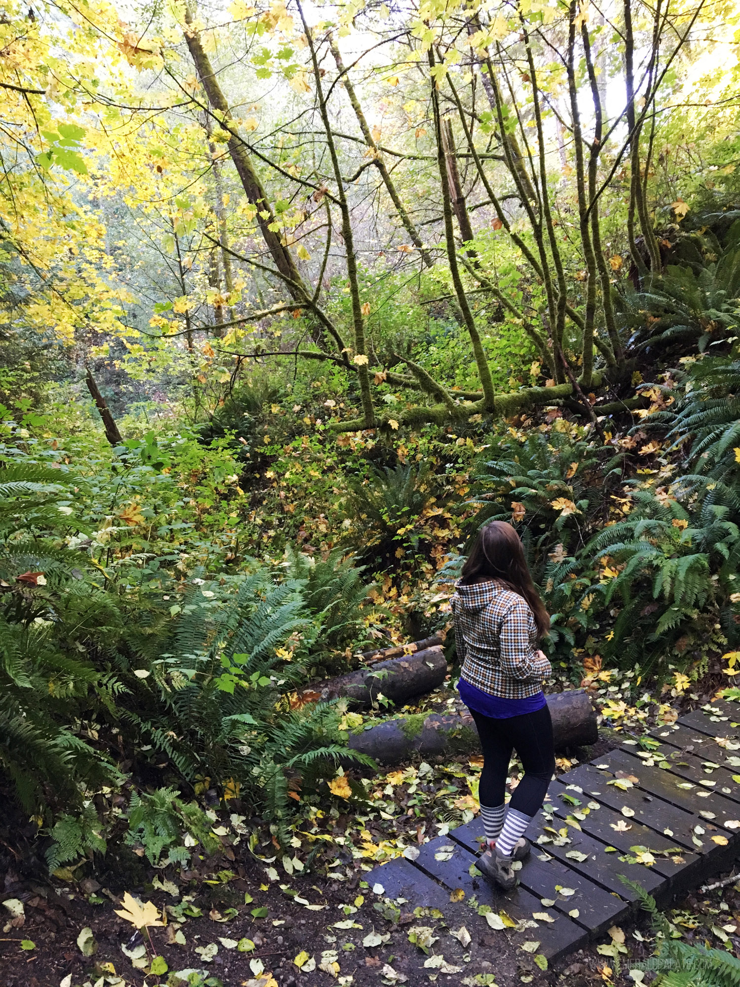
There are so many great things to do on Vashon Island, and one of those is a hike at Shinglemill Creek Preserve. It’s an overall easy hike that passed over private property, but there’s an area in the woods that is relatively steep and oftentimes wet and sandy with slippery traction.
Yet the effort is worth it to explore the fern-laden forest. During salmon season November to December, you’ll likely see fish swimming upstream. The stream lets out into a small beach area with tide pools leading out to the ocean. The vast difference from the thick woods you enter in makes this trail one of the best hiking spots in Seattle.
Maury Island Marine State Park
website | Vashon, WA (get directions) | distance from Seattle: ~1 hour, 20 minutes | length: 3 miles round trip | elevation gain: 500 feet | effort: easy | no pass required | leashed dogs allowed
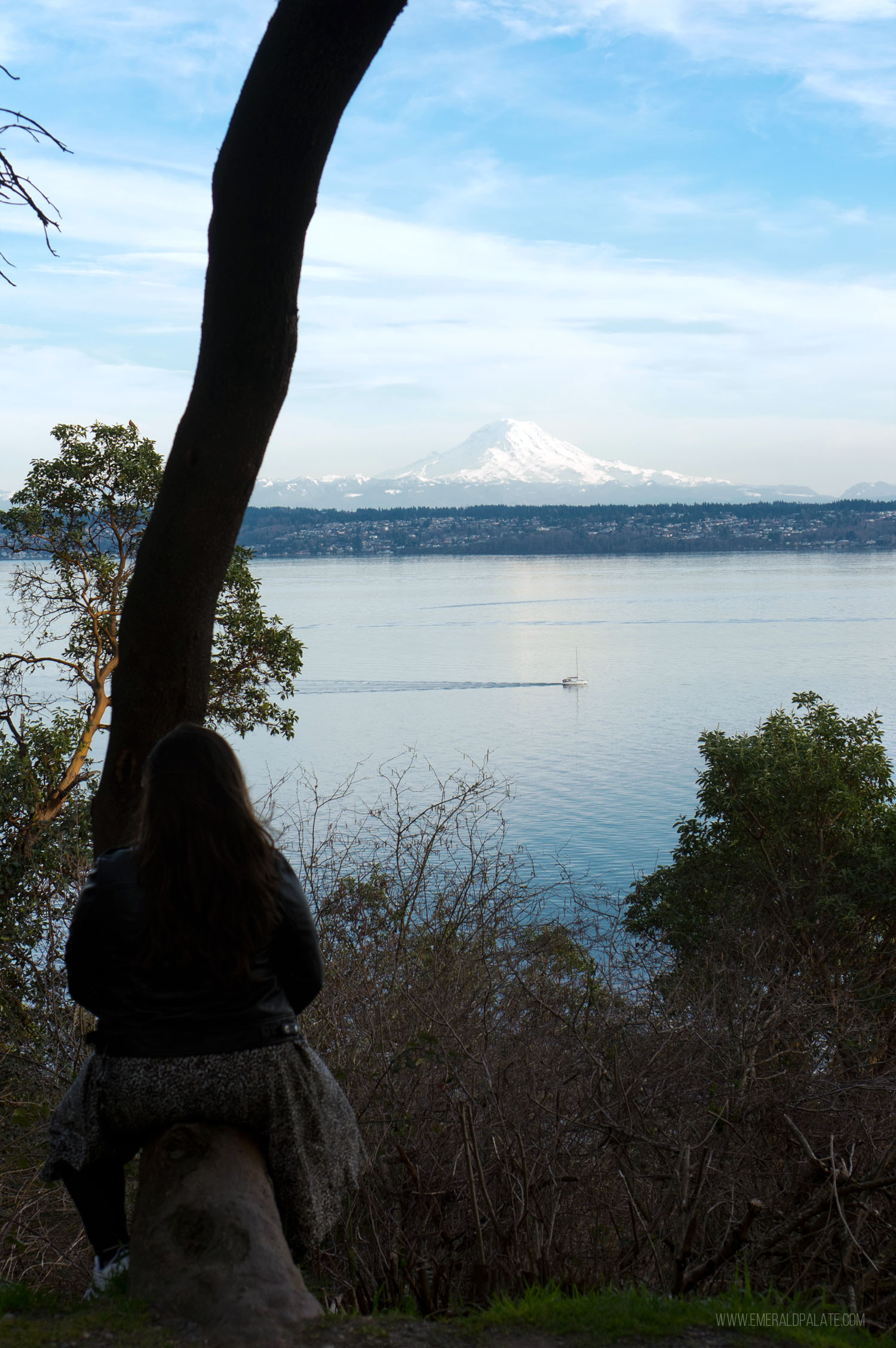
Maury Island State Park starts as a road leading from the parking lot down toward the water. It’ll weave past a ravine before getting to a slope that lead down to the beach. On the walk, keep an eye out for the rare Pacific Madrone trees, salt marsh, eelgrass beds, and wildlife.
As you get toward the cliff leading down to the water, you’ll be greeted with a view of Mount Rainier through the trees. Keep going down to the beach to get uninterrupted views of the majestic snow-capped peak.
Mount Pilchuck
website | Granite Falls, WA (get directions) | distance from Seattle: ~1.5 hours | length: 5.4 miles round trip | elevation gain: 2,300 feet | effort: difficult | Northwest Pass required | leashed dogs allowed
Mt. Pilchuck is a popular hike, which always amazes me because it’s a bit daunting. Not only is is a heart pumper, but there are a lot of false summits that can be confusing.
For example, you’ll come to an immediate fork at the trailhead. The left trail is a false path, so you’ll need to steer right toward the small stream (that yes, you need to cross). There aren’t a lot of signs as you continue, so if you’re unsure follow the crowd or ask.
About a mile in you’ll come to sign that says 3,500 feet elevation. Don’t scramble up the slope, but instead look for the orange marker that will take you left through a boulder field. After about another half mile, expect to come out into a forest clearing where you can see the summit on a clear day.
After continuing up the slope, you should eventually come to a brown “parking area” sign on a tree. If you don’t see this sign, you may have wandered up a false summit.
If you made it to the correct summit, though, it’s absolutely breathtaking. It provides 360-degree views of the Cascade Mountains, Mt. Baker, Mt. Rainier, and the Olympics. The crown jewel, though? The historic fire lookout built in 1921 that you can camp in on a first come, first serve basis.
Lake 22
website | Granite Falls, WA (get directions) | distance from Seattle: ~1.5 hours | length: 5.4 miles round trip | elevation gain: 1,350 feet | effort: moderate to difficult | Northwest Pass required | leashed dogs allowed
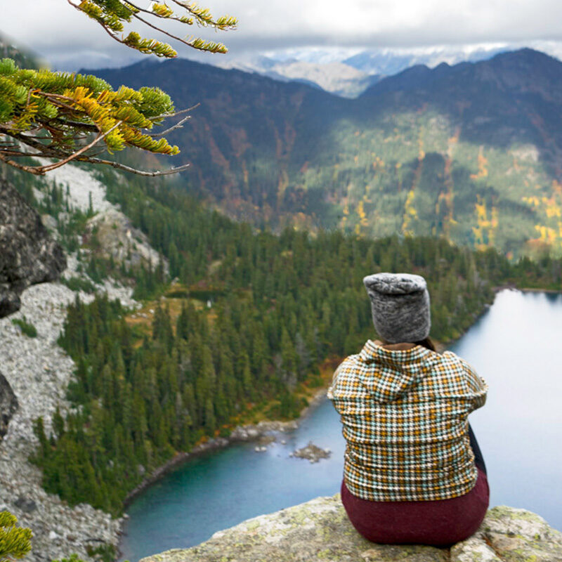
Lake 22 is one of the best hiking spots in Seattle if you love alpine lakes and lush forest trails. It weaves through old-growth trees and ferns before coming to a brief clearing that gives you view of Mt. Pilchuck on a clear day. Then it heads back into the forest before reaching the pretty lake.
There’s a trail that loops around the lake. Take it and enjoy the views, but don’t be tempted to scramble up the boulders. There have been fatalities of those who attempted it.
Make sure to wear waterproof shoes, as this trail is always wet and you’ll likely need to cross a few creeks. It gets a lot of snow, typically, so this hike is best in warmer weather unless you’re equipped with snowshoes or spikes.
Heybrook Lookout
website | Gold Bar, WA (get directions) | distance from Seattle: ~1.5 hours | length: 2.6 miles round trip | elevation gain: 850 feet | effort: easy | no pass required | leashed dogs allowed
Heybrook Lookout is one of the best hiking spots in Seattle because it has big views for little effort. While the ascent is moderately steep, the trail is only a bit over a mile each way. The most strenuous part will be the stairs you take to go up the fire lookout once you get to the end.
The parking lot is a glorified shoulder off the highway, so be careful not to miss it. From there, you’ll be led along a fern and moss covered forest toward the lookout. You may think this hike doesn’t have much to see, but once you get to the top of the lookout you’ll have gorgeous mountain views.
Ebey’s Landing National Historic Reserve
website | Coupeville, WA (get directions) | distance from Seattle: ~1.5 hours | length: 5.6 miles round trip | elevation gain: 260 feet | effort: easy | Discover Pass required | leashed dogs allowed
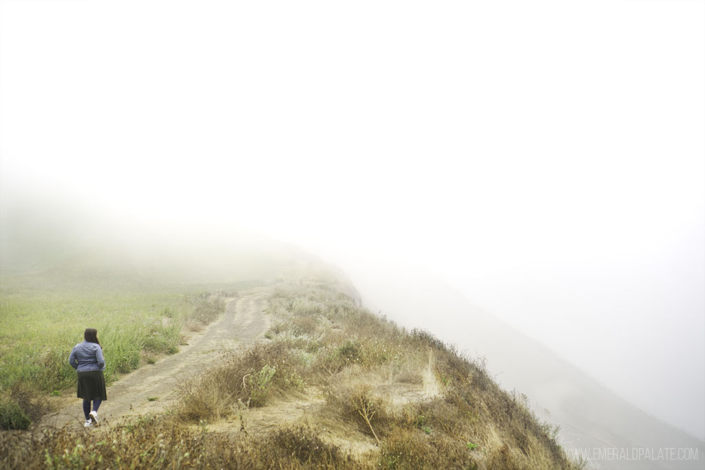
Ebey’s Landing is one of the best things to do on Whidbey Island, an island off Seattle that’s popular for day trips and weekend getaways alike. It has a trail that weaves through farmland to a bluff overlooking a beach, which offers breathtaking views of Mount Baker, the Cascades, and the Olympics.
You can access the Bluff Trail from the Prairie Overlook Trail by the Sunnyside Cemetery or the parking lot at the end of Ebey’s Landing Road. I recommend the Prairie Overlook Trail parking lot for a longer-but-easy hike to the historic Jacob Ebey House.
Once you get to the bluff you’ll get pretty views of the ocean and a bunch of wildflowers in the summer. Keep your eyes peeled for birds as you descend toward the beach.
Pro tip: Ebey’s Landing takes you through private property, so be respectful and stay on the marked trails.
Deception Pass State Park
website | Oak Harbor, WA (get directions) | distance from Seattle: ~1 hour, 20 minutes | length: 5 miles round trip | elevation gain: 350 feet | effort: easy | Discover Pass required | leashed dogs allowed
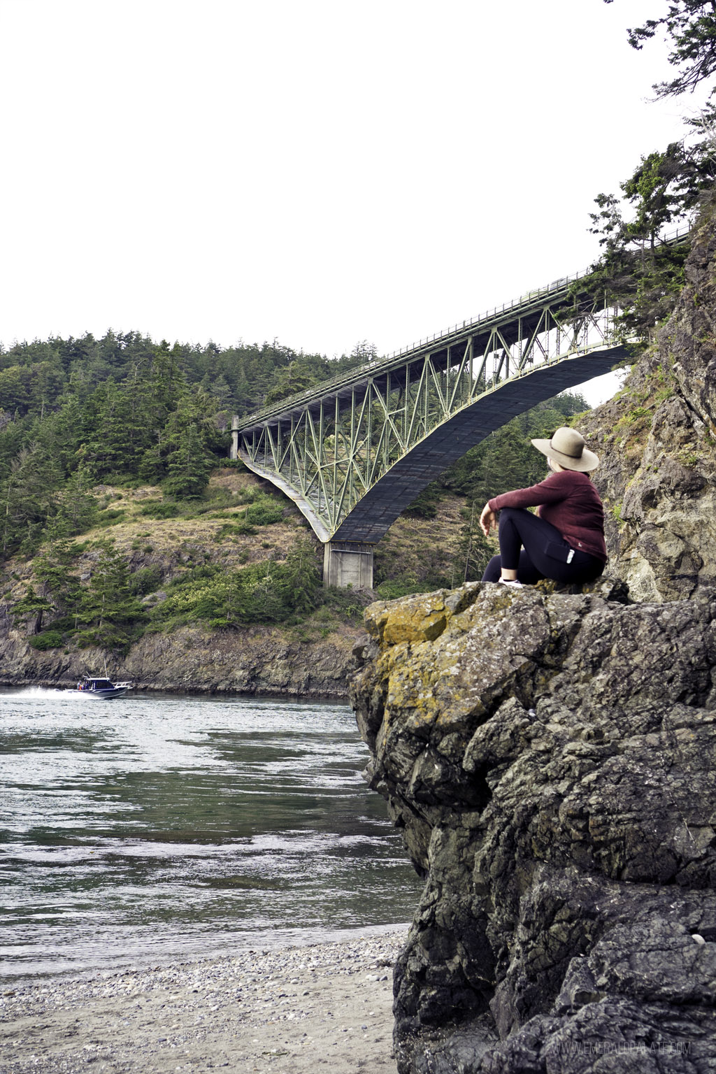
Deception Pass is the waterway that separates the mainland from Whidbey Island. Whidbey is one of the few islands you can drive to thanks to the pretty mint green Deception Pass Bridge. Many people simply marvel at the views while never leaving the car, but that’s a mistake because Deception Pass State Park is one of the best hiking spots in Seattle.
You can access the park from either side of the bridge. The part on the mainland will take you to Bowen Bay and Lighthouse Point, two areas with epic photo opportunities. If it’s the summer you can also access Rosario Beach where you may see seals, birds, and even whales.
I like the area on the Whidbey Island side. As soon as you cross the bridge from the mainland, there’s a small parking area to your right. Pull in and take the stairs down to North Beach for interesting views of the bridge from below.
Map of Seattle’s best hiking spots
Curious where all of these best hiking spots in Seattle are in relation to each other? Here’s a map to give you a sense of space.
More outdoor adventures
After you cross these best hiking spots in Seattle off your list, check out these other outdoor adventures around Washington.
- Best Hikes at Mount Rainier National Park
- The Perfect Mt. Rainier National Park Day Trip
- Magical Larch Hikes in Washington for Fall Colors
- Beautiful Fall Foliage in Seattle
- Can’t-Miss Washington Coast Attractions
- The Ultimate Columbia River Gorge Itinerary
- Best Cross-Country Skiing and Snowshoeing in Washington
